2022 May 24 to June 4
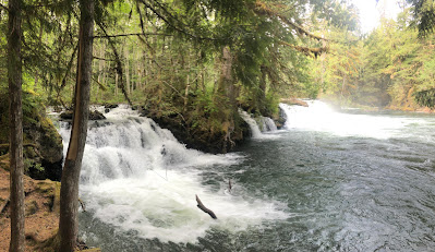
From the North Pacific Cannery, we returned to the highway and then headed east, back towards Terrace, where we took the Nisga’a Highway northwards, with stops at Kitsumkalum Lake, Tumbling Creek, the “Lava Flow” -where a 20 min walk took you to the limit on the lava river, bringing back memories of lava flows in Iceland-, then the Drowned Forest, Beaupre Falls, and Vetter Falls, finally reaching the Nisga’a Lava Campground, which was a lot more comfortable than it sounds. In this area, we saw black bears frequently, and this continued as we went north. The highway is relatively light in terms of traffic, and there is a sense of being remote, which is good.

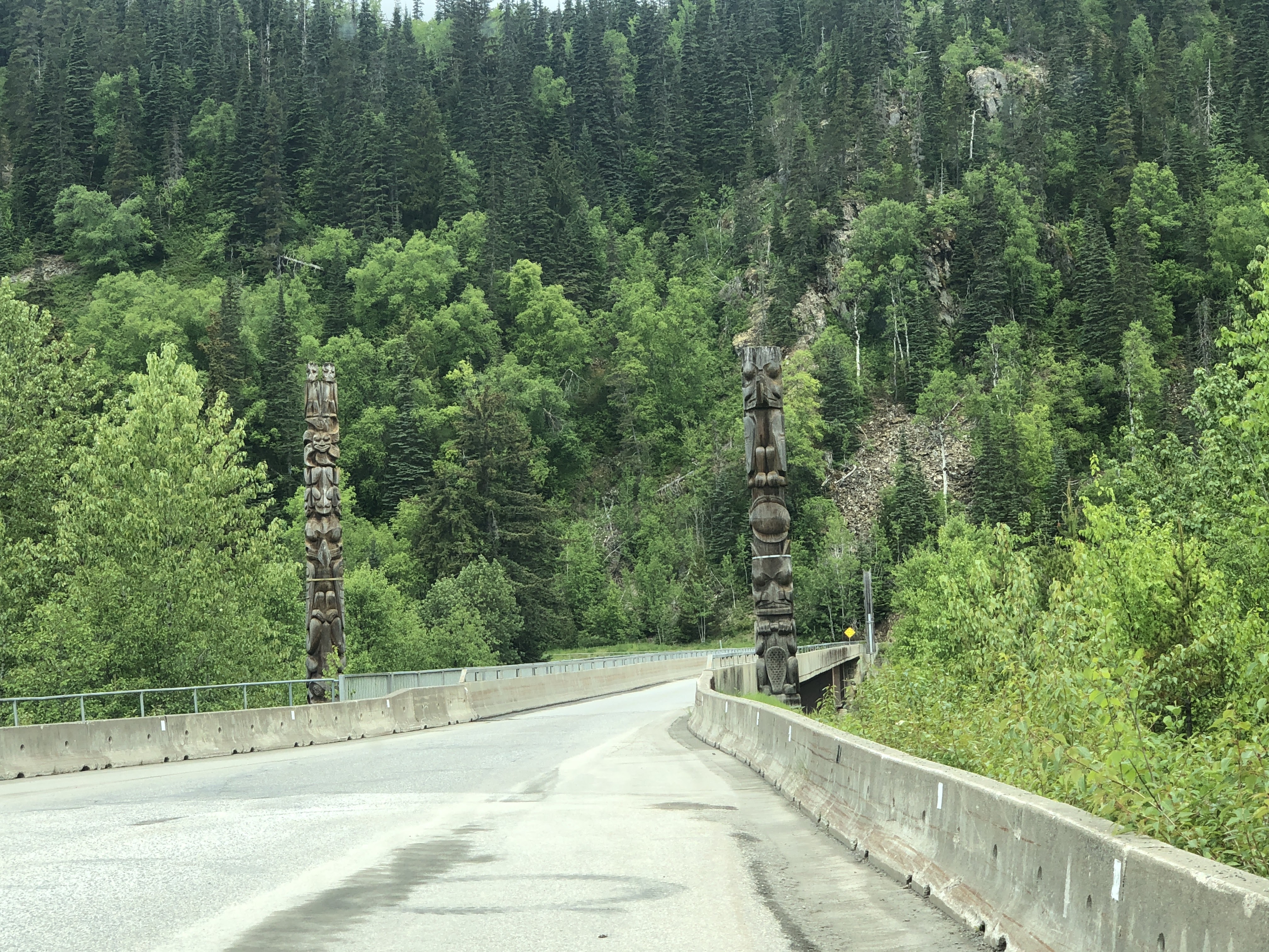
This is Nisga’a country, and there is a cultural center to the southwest of the campground, which is reported to be excellent. We headed there, calling ahead to confirm that it would be open, given our experience so far that visitors’ centers and cultural centers were closed in most cases, however, we were pleased to learn that it would indeed be open. On the way, we visited the lava field again, as well as the Tseax River, the totem poles at Gitlaxt’aamiks, a lava tube, the village of Gitwinksilhkw, where we enjoyed espresso and ice cream overlooking the river and the totem poles, and finally reached the Nisga’a Museum at Laxgalts’ap, which turned out to be excellent!
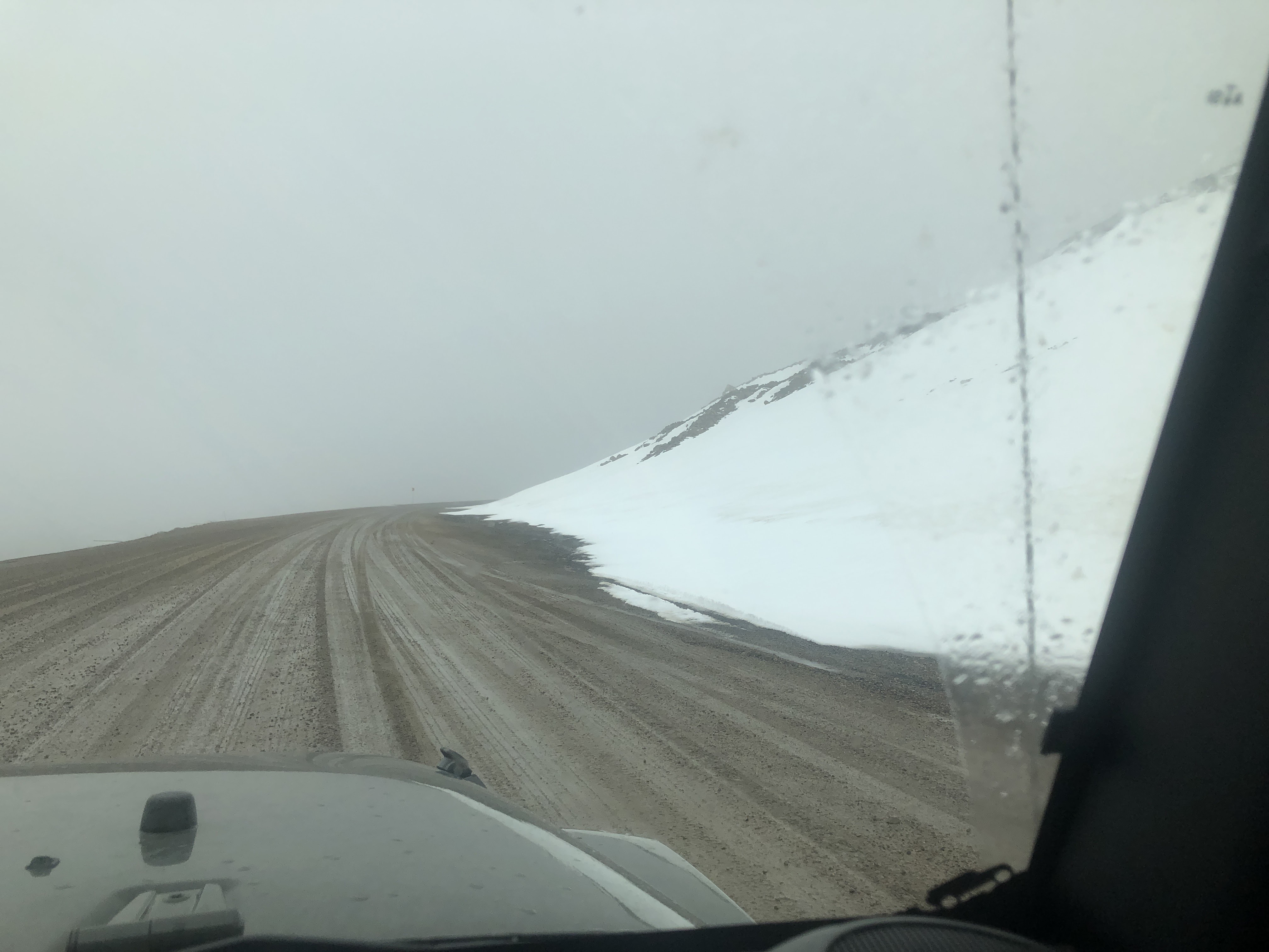
Returning to the highway junction, we took route 37 north, which is an unsurfaced highway, with hardly any traffic, and on which we enjoyed the beautiful rapids on the river, and saw black bears again.
After a while, we rejoined the Stewart-Cassier Highway and continued to Meziadin Lake. On refueling, Alan forgot to put the gas cap, but we only realized this 10 km after leaving. Surprisingly, we found the gas cap at the side of the road while returning to the gas station, however, an O-ring had been lost, but we only noticed after a series of vehicle alarms started going off (which were resolved in Whitehorse).
From Meziadin Lake we headed to Stewart, seeing more grizzly and black bears on the way, through a stunning mountain scenery to this small town on the lake, which seems to remain in the 19th century in terms of its architecture. We dined at the aptly named Silverado Café Pizza Parlor, having walked to the lakeside on the boardwalk, and enjoyed the old wooden buildings in the center.
Taking in more time in Stewart in the morning, and visiting the museum, we returned eastwards to the Stewart-Cassiar Highway. While following the road northward, we stopped at Bell 2 Lodge (for soup and the acquisition of two Kühl jackets at significant discounts), Bob Quinn Lake, Kinaskan Lake, the Stikine River, Lower Gnat Lake, and finally Water’s Edge Campground, on Dease Lake, all this while having the occasional sight of the various bears we could catch from the road. The camp warden was friendly, and bird life was rich on the way.
The following day was replete with more bears, as we continued north via Sawmill Point recreation area, Simmons Lake, Jade City, and then Boya Lake, where we walked the Beaver Lodge Trail, which was a beautiful walk on the lakeshore, although no beavers were taking place at the lodge. We had also made the short side trip to see Cassiar, once a very important mine, now not much more than a mine dump and a car wrecker.
Yukon
We crossed the border into Yukon and continued to Watson Lake Campground. We had now reached a somewhat different ecosystem, although the change had been gradual and so not very evident. Here we saw our first caribou and snow geese.
Continuing our travels, we visited Albert Creek, although we couldn’t find the banding station despite it being signposted. Then we went to Rancheria Falls, passed through the Morley River Recreation Site, went back to visit Morley Lake, and followed to Teslin, stopping to enjoy a late lunch at Kimmy’s Yum Yum food truck, to then finally reach the Teslin Lake Campground.
From here, we made our way via Johnson’s Crossing Lodge to the Tagish bridge, then west to Carcross, where we walked the old town and the few places that were open.
Carcross has several interesting art establishments, however, none were open while we stayed there. On the day of our departure, we took a short walk through the Carcross Desert, described as the smallest desert in the world, after that, we passed Emerald Lake, Swan Haven (popular with swans during their migration, but not as we stopped to see the place), and on to Marsh Lake where we would spend a few days of our upcoming “work week”. We couldn't find a place for the whole week, so we had to move mid-week into Whitehorse (really Carcross Cutoff). The place in Marsh Lake was full of character, and we walked down to the lake one day.
Exploration in the area included Miles Canyon and Atlin Lake; Atlin is an interesting village on the lake, with old wooden buildings, a good lunch at the Mountain Lodge, and no cellular service.
Exploration in the area included Miles Canyon and Atlin Lake; Atlin is an interesting village on the lake, with old wooden buildings, a good lunch at the Mountain Lodge, and no cellular service.
On our way to our second place “in” Whitehorse, we stopped at the Wolf’s Den, where we had an interesting conversation with Tonna, who made coffee for us and told us tales of her out in the wild.
We took advantage of our time in/around Whitehorse for grocery shopping, obtaining a new gas cap (which fixed the alarms on the vehicle), going to the huge Coast Mountain Sports shop, and picking up some other items. We enjoyed the excellent MacBride Museum of Yukon History, and after a Gwich’in Council get-together with music. The Kwanlin Dun Cultural Centre and library next door were well worth our visit. Art and craft interests were satisfied with visits to the Yukon Arts Centre, Art Underground, Yukon Artists @work, North End Gallery, and Itsy Bitsy Yarn. We dined at the iconic Klondike Rib and Salmon and at the excellent Wayfarer Oyster House, as well as finding Midnight Sun Coffee Roasters, where we had excellent coffee. The Fireweed Farmers’ Market proved interesting, and we found the diversity of people there, both selling and buying, very welcome.
On our last morning, we stopped for fuel, had another coffee at Midnight Sun Coffee Roasters, and continued to the Yukon Wildlife Preserve, where one could see animals from the region. The center is extensive, with a 5 km walk to see it all.
We then headed west to Haines Junction via Canyon Creek to stay at Kathleen Lake campground. From there, we’ll set off to explore Kluane National Park.
Our next stages of the trip:
We plan to explore the Kluane National Park, then return to Whitehorse and head north, to Dawson City, then onwards and northwards…
Hugs
Alan & Marce
(Photos
may be used for non-commercial purposes, with credit to alanymarce@gmail.com)